ESL Jigsaws
5 Minutes Prep - 2 Hour Interactive Lesson!
Canada Day Fun with Maps
Canada Day is approaching. After teaching a unit on Canada, it can be fun to divide students into groups of three, give each group a large sheet of chart paper and ask them to draw the map of Canada. Make sure all Canada maps in your classroom are covered for this exercise. Have each group label the provinces and their capital cities on their map. Once each group has finished, you can display the maps around the classroom. Worthwhile learning can take place as they compare their maps to a real map and realize what they had out of proportion or incorrectly labeled.
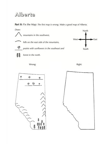
Another fun exercise is Alberta map drawing, found in Callan's Beginner Canada Jigsaws. Students learn the geography of Alberta (mountain, hills, prairie and forest) as well as vocabulary for directions (north, south, east, west, southeast, southwest). This can be done with any province, but the geography of Alberta particularly lends itself to this type of exercise.
Click on the image below to view a PDF version large on your computer. You can then download it for use in your own beginner or intermediate English language learning class. Full units on each of the provinces can be found in Callan's Beginner Canada Jigsaws.
If you are looking for something for higher levels, perhaps for an intermediate CLB 4, 5 or 6 class, consider becoming a field tester for the upcoming Callan's Canada Jigsaws. Apply to become a volunteer field tester by sending information about yourself and your class here.
Post your comment
Comments
No one has commented on this page yet.
RSS feed for comments on this page | RSS feed for all comments


